On Saturday the 19 of October my wife and I left for a van camping trip down the Oregon Coast to Cresent City California and back. I took my sailing gear but did not get to use it. More about that later.
On Sunday the 20th it rained hard and was quite windy. We stayed at Beverly Beach and then headed South Monday morning with much better weather. NOAA was forcasting very large surf for the Central Coast. They said some places could see 36 feet. This doubles the largest surf I had ever seen before.
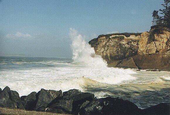
Our first stop was the South Jetty at North Bend. Here is a picture to give you an idea of what was going on:
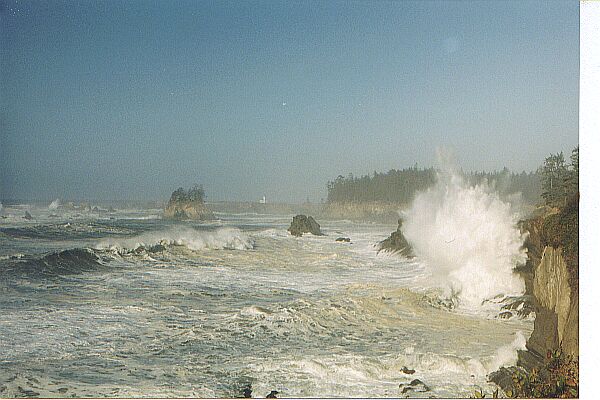
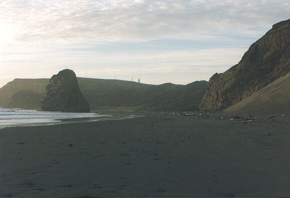
We then drove on South to Coos Bay and the Charleston Beach area. We visited Sunset Beach and here is a picture looking North from the view point towards the light house:
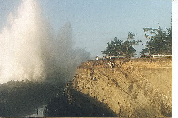
Our next stop was Shore Acres. This place was amazing. We parked in the parking lot and headed out to the view point. We were on the point that is just North of the building with the glassed in viewing area. As we came to the end of the point this is what we saw:
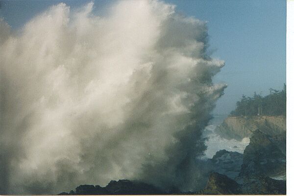
Waves were coming onto Simpson's reef and splashing right up in front of the point. We watched this for a little while and then headed North along the bank to look at some of the other parts of the reef. Just after we left a wave hit the reef straight on and came up over the viewing area. The viewing area was about 100 feet over the water. There were two older women on the point when this happened. I talked to one of them later and she told me that they tried to run but realized that they could not escape so they grabbed hold of the railing to keep from being washed off the point and into the ocean. The wave was about 40 or 50 feet over the trees at the end of the point so my guess is the total height of the water was between 150 and 175 feet. Here is a view of the point with a small wave breaking. You can see people standing below the trees at the end of the point:
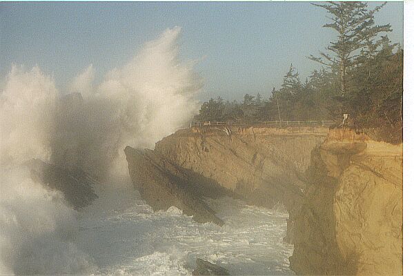
There was so much spray in the air that even on a bright sunny day you could not see very far up or down the coast. Here is another picture showing a wave similar to the one that got the women wet.
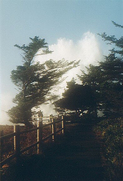
Here is a picture of the view point where the women were standing and the rail that they used to keep themselves on top of the point. What looks like a cloud at the end of the point is a wave.
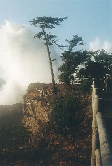
Nature can do some amazing things at times. Here is another picture of the trail with a large wave breaking.
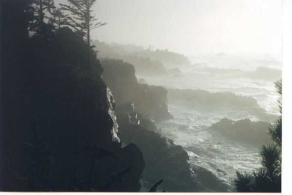
There was so much water in the air that the optics was not real good. Here is a shot looking South.
We then visited Cape Blanco Light House.
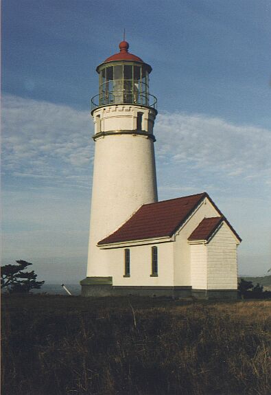
The light house sits on a point that is connected to the land by a small section of land. There are three continential plates that come together under the road connecting the light house to the land. They have marked these fault lines with white markers. They are only about 20 feet apart. This would probably not be a good place to stand during an earth quake. Here is a view from the beach:
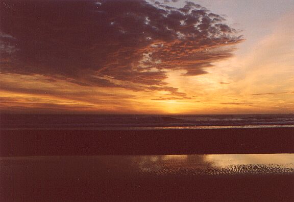
Here is a sunset from Cape Blanco: